Are we in for a historically cold winter? It’s the question on everyone’s mind as forecasts hint at a rare convergence of a weak La Niña and a potentially record-early disruption of the Polar Vortex. The signals are complex, and the headlines can be even more confusing.
One forecast calls for a mild season, another predicts a deep freeze. Who should you believe? This winter, the answer isn’t simple, but it is fascinating. The competing forces in the atmosphere are setting the stage for a season of sharp contrasts and regional extremes.
This is your definitive guide. We will cut through the noise of conflicting 2025-2026 winter weather predictions to deliver a clear, comprehensive, and easy-to-understand forecast. We’ll explain not just what to expect, but why it’s happening and, most importantly, how you can prepare.
The Big Picture: A Tale of Two Winters
Get ready for a “bookend winter.” That’s the emerging theme for the 2025-2026 season, a period likely to be defined by a harsh, cold, and snowy start, a potential mid-winter thaw, and a stormy return just when you think spring is around the corner. It’s a story of two distinct halves, driven by a fascinating atmospheric tug-of-war.
The two main characters in this story are La Niña, the famous climate pattern in the Pacific Ocean, and the formidable Polar Vortex swirling high above the Arctic. Their unusual interaction this year is the primary source of the forecast’s complexity, promising a winter that will keep us on our toes.
[Image Description: A high-level overview map of the United States. The northern third of the country, from the Pacific Northwest through the Midwest and into New England, is shaded in blue and labeled “Colder & Wetter.” The southern third, from California across to Florida, is shaded in a light orange and labeled “Warmer & Drier.” The central part of the country is a blended gradient, labeled “The Battleground.”]
The Science Made Simple: Decoding La Niña and the Polar Vortex
To truly understand the 2025-2026 winter weather predictions, we need to look at the engines driving our weather. This year’s cold winter forecast is shaped by complex interactions. Forget the dense scientific papers; let’s break down these powerful forces with simple analogies.
What is La Niña, and Why is This One Different?
Imagine the tropical Pacific Ocean is a giant bathtub. La Niña occurs when a large patch of that water becomes cooler than normal. Think of this cool patch as a giant rock placed in a steady stream. It forces the water—or in this case, the jet stream and global weather patterns—to bend and flow around it.
This redirection is why La Niña winters often bring colder, stormier weather to the northern U.S. and drier, warmer conditions to the south. However, the La Niña winter forecast for 2025-2026 comes with a twist. This is a *weak* La Niña, making its influence less of a sure thing. Furthermore, forecasters at NOAA expect it to fade and transition to “ENSO-neutral” conditions by spring 2026, meaning its strongest effects will be front-loaded into the early parts of winter.
The Polar Vortex: Is a “Collapse” on the Horizon?
Picture the Polar Vortex as a fast-spinning top of incredibly cold air, balanced perfectly high above the North Pole. As long as it spins quickly and stays stable, it keeps that frigid air neatly contained in the Arctic. But what happens when that spinning top starts to wobble?
That’s what forecasters are watching closely this year. A phenomenon called a “Sudden Stratospheric Warming” (SSW) event is predicted, which is like a powerful wave in the atmosphere that can knock the spinning top off balance. When the Polar Vortex in 2025 gets disrupted, it weakens and can split, allowing chunks of that Arctic air to spill southward. These are the events that bring the bone-chilling cold snaps that plunge deep into North America.
What makes this winter particularly interesting is the timing. Early-season Polar Vortex disruptions, like the one forecast for late December or early January, tend to have the most dramatic impacts. The effects can last for weeks, even months, as the atmosphere slowly reorganizes itself. Historical analogs suggest that winters with similar setups have produced some of the coldest and snowiest conditions on record for the eastern two-thirds of the United States.
The interplay between La Niña and the Polar Vortex is what meteorologists call a “constructive interference.” Both are pushing the weather pattern in the same direction: colder and snowier for the North, drier for the South. When these two forces align, the confidence in the forecast increases significantly. It’s like having two independent witnesses corroborating the same story.
Regional Deep Dives: Your Local 2025-2026 Winter Forecast
Weather is never one-size-fits-all. The same forces that bring a blizzard to one state can mean a mild, dry day for another. Here’s a detailed breakdown of what the 2025-2026 winter weather predictions mean for major regions across the United States.
| Region/City | Temperature Outlook | Precipitation/Snowfall Outlook | Key Takeaway |
|---|---|---|---|
| Northeast & New England (NYC, Boston) | Colder than average, especially early winter | Above-average snowfall, risk of nor’easters | Get the snow shovels ready for a classic, stormy winter. |
| Mid-Atlantic (D.C., Philadelphia) | Slightly below average | Wintry mix is likely; a battleground for rain vs. snow | Expect messy commutes and fluctuating conditions. |
| Southeast (Atlanta, Miami) | Colder than recent winters | Below-average precipitation | A chilly, dry winter is in store; protect your plants. |
| Midwest & Great Lakes (Chicago, Detroit) | Consistently colder than average | High chance of above-average snow, including lake-effect | The heart of the winter cold and snow this year. |
| The Plains (Kansas City, Minneapolis) | Significantly colder than average | Above-average snowfall likely | Prepare for early and persistent Arctic air. |
| Texas & Gulf Coast (Houston, New Orleans) | Warmer than average overall | Below-average precipitation | Mostly mild, but watch for a potential late-season freeze. |
| Rocky Mountains (Denver, Salt Lake City) | A story of north vs. south | Snowier in the north (ID, MT, WY); drier in the south (CO, UT) | Ski season looks great in the north, less so in the south. |
| Southwest (Phoenix, Las Vegas) | Warmer than average | Drier than average | Drought conditions are likely to worsen. |
| Pacific Northwest (Seattle, Portland) | Near average temperatures | Wetter than average, with significant mountain snow | A classic wet winter is on tap, a boon for the snowpack. |
| California (LA, San Francisco) | Warmer than average | Below-average precipitation | Unfortunately, another dry winter will heighten drought concerns. |
The Northeast and New England are bracing for a classic winter. The combination of a La Niña-influenced storm track and potential Polar Vortex disruptions means a higher-than-average chance for significant snowstorms, especially in the December to January timeframe. Cities like Boston and New York City should prepare for a snowier season than the last few years, with cold air firmly in place. Boston, in particular, could see seasonal snowfall totals approaching 50-60 inches, well above the 30-year average of 49 inches. New York City may receive 30-35 inches, a welcome change from the below-average winters of recent years. The risk of nor’easters is elevated, particularly in late January and early February when ocean temperatures remain relatively warm, providing ample moisture for coastal storms.
For the Mid-Atlantic, it’s a familiar story of being on the edge. Cities like Washington, D.C., and Philadelphia will be the battleground between the Arctic air to the north and milder air to the south. This means a high likelihood of messy wintry mix events, where a storm can start as snow, change to sleet and freezing rain, and end as rain. These are often the most disruptive systems for travel. Philadelphia could see 20-25 inches of snow for the season, with several events producing 3-6 inches. Washington, D.C., may receive 15-20 inches, though the city’s notorious rain-snow line will make forecasting individual storms particularly challenging. The I-95 corridor from Baltimore to Richmond will be especially prone to these mixed precipitation events.
The Southeast is in for a surprise. While the rest of the country talks snow, regions from Atlanta to Raleigh can expect a winter that is noticeably colder than recent years. However, the storm track is expected to stay north, leading to drier-than-average conditions. The biggest risk here will be protecting sensitive plants from more frequent and deeper freezes.
If you’re in the Midwest and Great Lakes, prepare for the heart of winter’s fury. This region is in the direct path of the projected storm track and is highly susceptible to Arctic outbreaks. Chicago and Detroit are forecast to have a consistently cold and snowy winter, with frequent lake-effect snow events adding to the totals. Chicago’s O’Hare Airport could record 45-50 inches of snow, above the average of 38 inches. Detroit may see similar totals, with 40-45 inches expected. The real story, however, will be in the lake-effect snow belts. Cities like Buffalo, Erie, and the western shores of Michigan could see seasonal totals exceeding 90-100 inches. Residents in these areas should prepare for multiple significant snow events, some producing 12-24 inches in a single storm.
The cold will be even more pronounced across The Plains. From Minneapolis down to Kansas City, the forecast favors early, deep, and persistent cold. The open landscape provides no barrier to Arctic air spilling south, making this region one of the most likely to experience significantly below-average temperatures for long stretches.
It’s a different story for Texas and the Gulf Coast. The overarching pattern suggests a winter that is warmer and drier than average. However, AccuWeather forecasters warn not to get too comfortable. The potential for a late-season Polar Vortex disruption in January or February could send a significant freeze plunging deep into the South, catching many off guard.
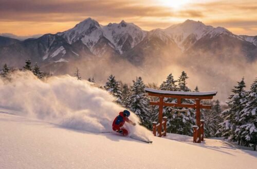
The Rocky Mountains will see a tale of two winters. The northern Rockies in Idaho, Montana, and Wyoming are positioned to receive abundant snowfall, promising a fantastic ski season. Conversely, the southern Rockies in Colorado and Utah are on the drier side of the jet stream, likely leading to a disappointing season for snow enthusiasts.
Unfortunately, the Southwest and California are on the losing end of this winter’s pattern. A persistent ridge of high pressure is expected to block storms, leading to a warmer and drier-than-average season. This is unwelcome news for regions already struggling with long-term drought, as the winter is unlikely to provide much relief.
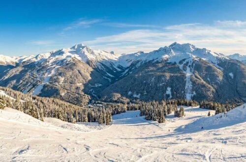
Finally, the Pacific Northwest is set for a return to a classic, wet winter. The La Niña pattern typically directs a firehose of moisture into Washington and Oregon. This will mean plenty of rain in Seattle and Portland and, more importantly, a healthy buildup of mountain snowpack, which is crucial for the region’s water supply.
The Climate Change Context: How a Warming World Affects Winter
It might seem paradoxical to talk about climate change in the context of a forecast for a colder, snowier winter. However, understanding the relationship between a warming planet and winter weather extremes is crucial for making sense of the 2025-2026 winter weather predictions.
The Arctic is warming at roughly twice the rate of the rest of the planet, a phenomenon known as Arctic amplification. This rapid warming has profound effects on the jet stream and the Polar Vortex. Some research suggests that a warmer Arctic can lead to a “wavier” jet stream, which allows cold air to plunge farther south more frequently. In other words, while the planet as a whole is warming, certain regions can still experience intense cold snaps and heavy snowfall.
The Polar Vortex disruptions that are becoming more common may be linked to this Arctic warming. When the temperature difference between the Arctic and mid-latitudes decreases, the jet stream weakens and meanders more, creating the conditions for cold air outbreaks. This doesn’t mean climate change is causing colder winters overall—global average temperatures continue to rise—but it does mean that the variability and extremes of winter weather may be increasing.
Another factor is the changing nature of snowfall. A warmer atmosphere can hold more moisture, which means that when conditions are right for snow, the snowfall can be heavier and more intense. This is why some of the biggest snowstorms in recent history have occurred during relatively mild winters. The 2025-2026 winter could see this dynamic at play, with bursts of heavy snow punctuating periods of more moderate temperatures.
It’s also worth noting that the long-term trend is toward shorter winters and earlier spring thaws, even as individual winters can still be harsh. The snowpack in the western mountains, for example, is melting earlier each year, which has significant implications for water supply. This winter’s forecast for below-average snow in the southern Rockies and California is consistent with this longer-term trend and highlights the ongoing challenges posed by climate change.
Understanding this context doesn’t change the immediate forecast, but it does provide a framework for thinking about winter weather in a changing climate. The 2025-2026 winter may be cold and snowy for many, but it’s part of a larger, more complex story about how our planet’s climate is evolving.
What History Teaches Us: Similar Winters from the Past
One of the best ways to understand what might lie ahead is to look back at winters with similar atmospheric setups. While no two winters are exactly alike, historical analogs can provide valuable insights into the range of possible outcomes for the 2025-2026 winter weather predictions.
The winter of 2010-2011 stands out as a particularly relevant comparison. That season also featured a weak-to-moderate La Niña and a significant Polar Vortex disruption in late January. The result was a winter of extremes. The Southeast experienced record-breaking cold and snow, with Atlanta receiving over 10 inches of snow in a single storm. Meanwhile, the Pacific Northwest saw above-average precipitation, and the Southwest remained dry. The pattern bears a striking resemblance to what forecasters are predicting for this year.
Another useful analog is the winter of 2013-2014, which became infamous for the repeated “Polar Vortex” outbreaks that gripped the Midwest and East Coast. That winter saw multiple Arctic blasts, with temperatures plunging to -20°F or colder in cities like Chicago and Minneapolis. The Great Lakes froze to near-record extents, and lake-effect snow was relentless. If the Polar Vortex in 2025 behaves similarly, we could see a repeat of those conditions.
The winter of 2007-2008 also offers lessons. A weak La Niña led to a snowy season across the northern tier of the United States, with the Midwest and Northeast seeing above-average snowfall. However, the South remained relatively mild and dry, much like the current forecast. That winter demonstrated how La Niña can create sharp regional contrasts, with some areas experiencing harsh conditions while others remain relatively unscathed.
It’s important to note that while these historical comparisons are useful, they are not perfect predictors. Each winter is shaped by a unique combination of factors, and small differences in timing or intensity can lead to very different outcomes. However, these past winters do suggest that the 2025-2026 season has the potential to be memorable, particularly for those in the northern half of the country.
Your Winter Survival Guide: A Month-by-Month Plan
A forecast is only useful if you act on it. Knowing what’s coming is half the battle; the other half is preparation. Here is a practical, month-by-month guide to help you navigate the 2025-2026 winter with confidence. This is one of the most important parts of our 2025-2026 winter weather predictions.
December: The Prep Month
The forecast points to an early and aggressive start to winter. Use the relative calm of early December to get ahead of the storms. This is not the winter to procrastinate on preparation.
Start by conducting a thorough inspection of your home’s exterior. Check your roof for loose or damaged shingles that could lead to leaks when snow accumulates. Trim any tree branches that hang over your house or power lines, as heavy snow or ice can cause them to break. Test your heating system now, before you desperately need it. Replace the furnace filter and consider having a professional inspection if your system is more than 10 years old.
- Holiday Travel: Book flights for earlier in the day and choose non-stop routes if possible. If driving, pack an emergency kit in your car with blankets, water, snacks, a flashlight, and a portable phone charger. Monitor forecasts 3-5 days before your trip.
- Vehicle Readiness: This is the month to get snow tires on your car, especially if you live in the Northeast, Midwest, or Northern Rockies. At a minimum, check your all-season tire tread and replace your windshield wipers.
- Home Winterization: Clean your gutters to prevent ice dams. Seal drafts around windows and doors with weatherstripping. Insulate pipes in unheated areas like basements or crawl spaces to prevent them from freezing and bursting.
January: The Deep Freeze
This is forecast to be the heart of the cold for much of the country. The focus shifts from preparation to endurance and safety.
- Personal Safety: This is the month for serious cold-weather gear. Learn the signs of frostbite (numbness, waxy skin) and hypothermia (shivering, confusion). When outside, cover all exposed skin and wear layers.
- Energy Savings: Your heating bill will likely peak this month. Lower your thermostat by a few degrees, especially at night. Use a programmable thermostat if you have one. Consider using insulated curtains to keep warmth in.
- Shoveling Safety: Snow will be piling up. Shovel in short shifts to avoid overexertion. Push the snow rather than lifting it. If you have a history of heart problems, consider hiring someone to clear your driveway.
February: The False Spring?
Some forecasts hint at a potential thaw in February, but don’t be fooled. Some of the worst winter storms in history have occurred in late February and March.
- Don’t Pack Up Yet: Keep your winter gear accessible. A late-season storm can catch everyone by surprise. This is often when ice storms are most common, as temperatures hover right around the freezing mark.
- Restock Supplies: Check your stock of salt or ice melt. Make sure your shovels are in good shape. After a long January, it’s easy to run low on essential supplies.
- Watch for Flooding: If a significant snowpack is followed by a rapid thaw and rain, localized flooding can occur. Ensure your sump pump is working and that drainage areas around your home are clear.
Economic Ripple Effect of 2025-2026 Winter Weather Predictions
The 2025-2026 winter weather predictions extend far beyond a simple temperature forecast; they have real-world financial consequences. Understanding these economic ripples can help you budget and prepare for the hidden costs of a harsh winter.
Energy Costs: Regions facing the brunt of the cold—the Plains, Midwest, and Northeast—should budget for significantly higher heating bills. The persistent cold forecast for January means furnaces will be working overtime. Natural gas and heating oil prices are sensitive to demand, and a prolonged cold snap could lead to price spikes. Households in the Upper Midwest could see heating bills increase by 20-30% compared to last winter. The Energy Information Administration (EIA) projects that homes heated with natural gas will spend an average of $150-200 more this winter, while those using heating oil could see increases of $300-400. In the coldest regions, these costs could be even higher. Now is the time to consider energy-saving measures like programmable thermostats, insulated window treatments, and ensuring your home is properly sealed against drafts.
Agriculture: The forecast presents a dual threat. In the Southwest and California, the continued drought will strain water resources, impacting the winter vegetable crops that supply much of the nation. California produces over 80% of the nation’s winter lettuce, broccoli, and cauliflower. A dry winter will force farmers to rely more heavily on already-depleted groundwater reserves, driving up production costs that will eventually be passed on to consumers. Meanwhile, a potential late-season freeze in the Southeast and Gulf Coast could be devastating for early-blooming fruit trees and berry crops. Georgia’s peach crop and Florida’s citrus industry are particularly vulnerable. A hard freeze in late February or March, when trees are beginning to bud, could wipe out a significant portion of the harvest. This happened in 2017, when a late-season freeze caused over $1 billion in agricultural losses across the Southeast.
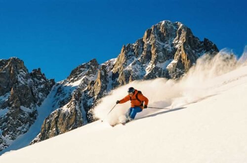
Tourism & Recreation: The ski industry will see clear winners and losers. Resorts in the Northern Rockies (Montana, Wyoming) and the Pacific Northwest are poised for a banner year with heavy snowfall. Jackson Hole, Big Sky, and Schweitzer Mountain could see some of their best seasons in years, attracting skiers and snowboarders from across the country. This will be a boon for local economies that depend on winter tourism. Conversely, resorts in the Southern Rockies (Colorado, Utah) and especially the Mid-Atlantic may struggle with less natural snow and warmer temperatures that make snowmaking difficult and expensive. Resorts in Vermont and New Hampshire will also face challenges, though they are better positioned than their Mid-Atlantic counterparts. For ski enthusiasts, this winter’s forecast suggests planning trips to the northern destinations for the best conditions.
Insurance & Home Repair: A cold, snowy winter inevitably leads to an increase in insurance claims. In the South, the biggest risk is burst pipes from unexpected freezes. In the snowy North, the primary concerns are roof damage from heavy snow load and ice dams, as well as an increase in vehicle accidents. Being proactive with home maintenance can save you thousands in potential repair costs.
FAQ: Your 2025-2026 Winter Questions, Answered
We’ve covered a lot of ground. Here are direct answers to some of the most common questions people are asking about the upcoming winter.
- 1. What is the winter of 2025-2026 going to be like?
- In short, expect a “bookend winter” that starts cold and stormy and ends the same way. The 2025-2026 winter weather predictions point to a colder, snowier season than average for the northern half of the United States, driven by a weak La Niña and a disrupted Polar Vortex. The southern U.S. is expected to be warmer and drier, worsening drought conditions.
- 2. Will winter 2025-2026 be cold?
- Yes, for many. The highest confidence for a colder-than-average winter is across the Plains, Midwest, Great Lakes, and Northeast, especially in December and January. The Southeast will also be colder than recent winters. However, the Southwest, California, and Gulf Coast will likely be warmer than average.
- 3. Will the 2025-2026 winter be a La Niña winter?
- Yes. We are currently in a weak La Niña pattern, and it is expected to influence the first half of the winter. The official NOAA winter outlook confirms it will likely fade and transition back to neutral conditions by the spring of 2026. This is a key factor in the La Niña winter forecast for 2025-2026, suggesting its impact will be most strongly felt early in the season.
- 4. How much snow will fall this winter?
- Snowfall will be above average for the Pacific Northwest, Northern Rockies, Plains, Midwest, Great Lakes, and New England. For example, cities like Buffalo could see 90-100 inches. In contrast, the southern Rockies, Southwest, and most of the Mid-Atlantic and Southeast will see below-average snowfall. Refer to our regional table above for more specific outlooks.
- 5. How accurate are long-range winter forecasts?
- Think of them as a strategic overview, not a precise daily forecast. Seasonal forecasts are good at predicting broad patterns (e.g., “colder and wetter than average”) for large regions. They are not designed to predict a specific snowstorm on a specific day. Their accuracy comes from identifying the large-scale climate signals, like La Niña, that tilt the odds in favor of certain outcomes over a three-month period.
- 6. How does this winter compare to last year?
- For many in the Northeast and Midwest, this winter is expected to be significantly colder and snowier than the relatively mild 2024-2025 winter. The “bookend” pattern is also different. In the West, however, the pattern is unfortunately similar, with another dry winter likely to worsen the ongoing drought.
Conclusion: Riding Out the Storm
The story of the 2025-2026 winter is one of complexity and contrast. These 2025-2026 winter weather predictions point to a front-loaded, colder-than-average season for millions, driven by the delicate dance between a weak La Niña and a wobbly Polar Vortex. From the heavy snows of the Great Lakes to the persistent drought in California, this winter will demand our attention and respect.
But a forecast is not fate. Being informed is the first and most critical step to being prepared. By understanding the risks and planning ahead—whether that means tuning up your furnace, buying a new shovel, or simply budgeting for higher heating bills—you can face the season with confidence, not anxiety.
Now we want to hear from you. What are you most concerned about this winter in your area? Share your thoughts in the comments below!